Program Description
The Gitksan territory encompasses approximately 30,416 km2 including a large portion of the Middle and Upper Skeena Watershed which is the the second largest watershed in British Columbia at 54,432 km2 as well as a large portion of the Upper Nass Watershed.
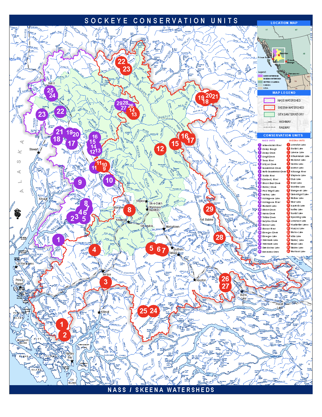
Long-term monitoring and assessment of fish within the Gitksan watersheds is essential to tracking changes to ecosystem health. Two ways we assess fish are: escapement counts (the number of fish that have escaped downriver capture attempts and made it to spawning grounds), and collecting baseline genetic data for the individual populations. Baseline genetic information can be used in future sampling of a group of mixed stock fish to identify each one to their population of origin (ie spawning stream). Genetic analysis can track diversity or the conservation units within a species as you can see in Nass and Skeena sockeye populations below. It can track changes in the genetic makeup of a population of fish that are key for precisely managing for the sustainability of these species.


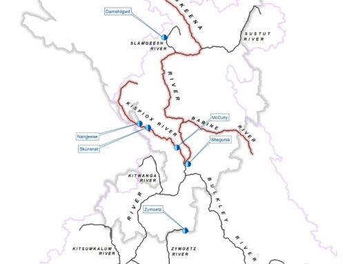
GWA has some capacity to conduct salmon enumeration and sampling programs with a focus in the Kispiox sub-watershed in the Skeena which has key indicators for all five species of salmon. Core spanner counts we do are: Swan/Stephens Lake sockeye, Kispiox River Chinook, River Type sockeye and index sites for Kispiox coho and chum. We also partner with: Bear/Sustut and Motase salmon counts with DFO and SFC (Automous Camera Fence), Upper Damdochax sockeye (Nass), Upper Zymoetz sockeye, and opportunistically or for genetic sampling: Upper Zymoetz coho, Upper Skeena sockeye and coho, Sicintine coho, Shegunia River Chinook, and Upper Gitsegucla coho.
Live salmon spawner counts throughout the spawning seasons are used to estimate escapement in each watershed. The three survey methods used are: stream walks, adult salmon counting weir (i.e. Slamgeesh Enumeration Fence), low level aerial surveys (helicopter or drone), the choice of which method employed being dependent on access and priority of each study location. Intermittent counting efforts are analyzed by area-under-the-curve (AUC) methods to produce an estimate of escapement for each stream surveyed. All salmon count report and estimates in the region are archived in a federal open source New Salmon Escapement Data System (NuSEDS) that we contribute to along with other studies and reporting. The GWA has worked collaboratively with wilp Gwininitxw on the Slamgeesh salmon project since the early 2000’s, and the project is now under the full management of the wilp.
Additional Resources:
Slamgeesh Salmon Program
2022 GWA General Technical Report
GWA Salmon Escapement Map


